See Your Space From A New Angle With Drone Aerial Photography in Brighton & the Surrounding Area
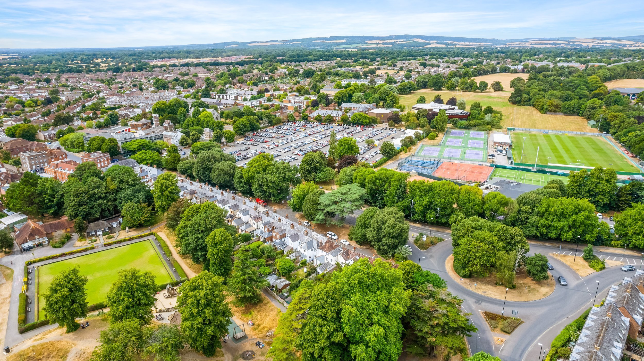
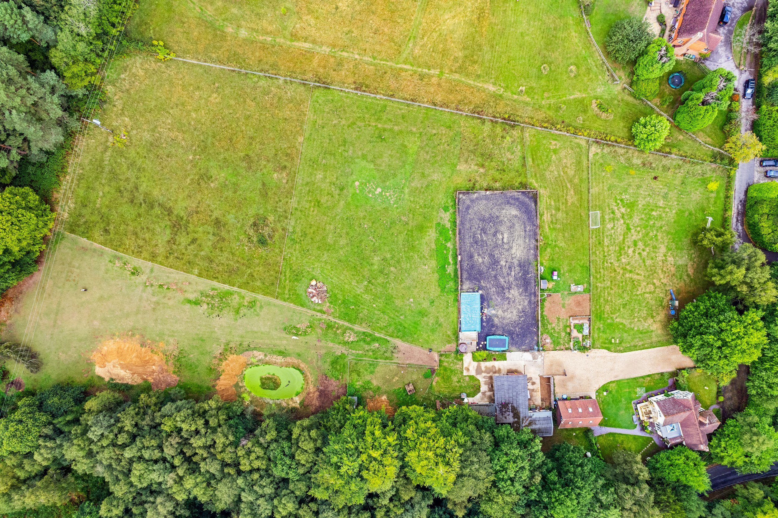
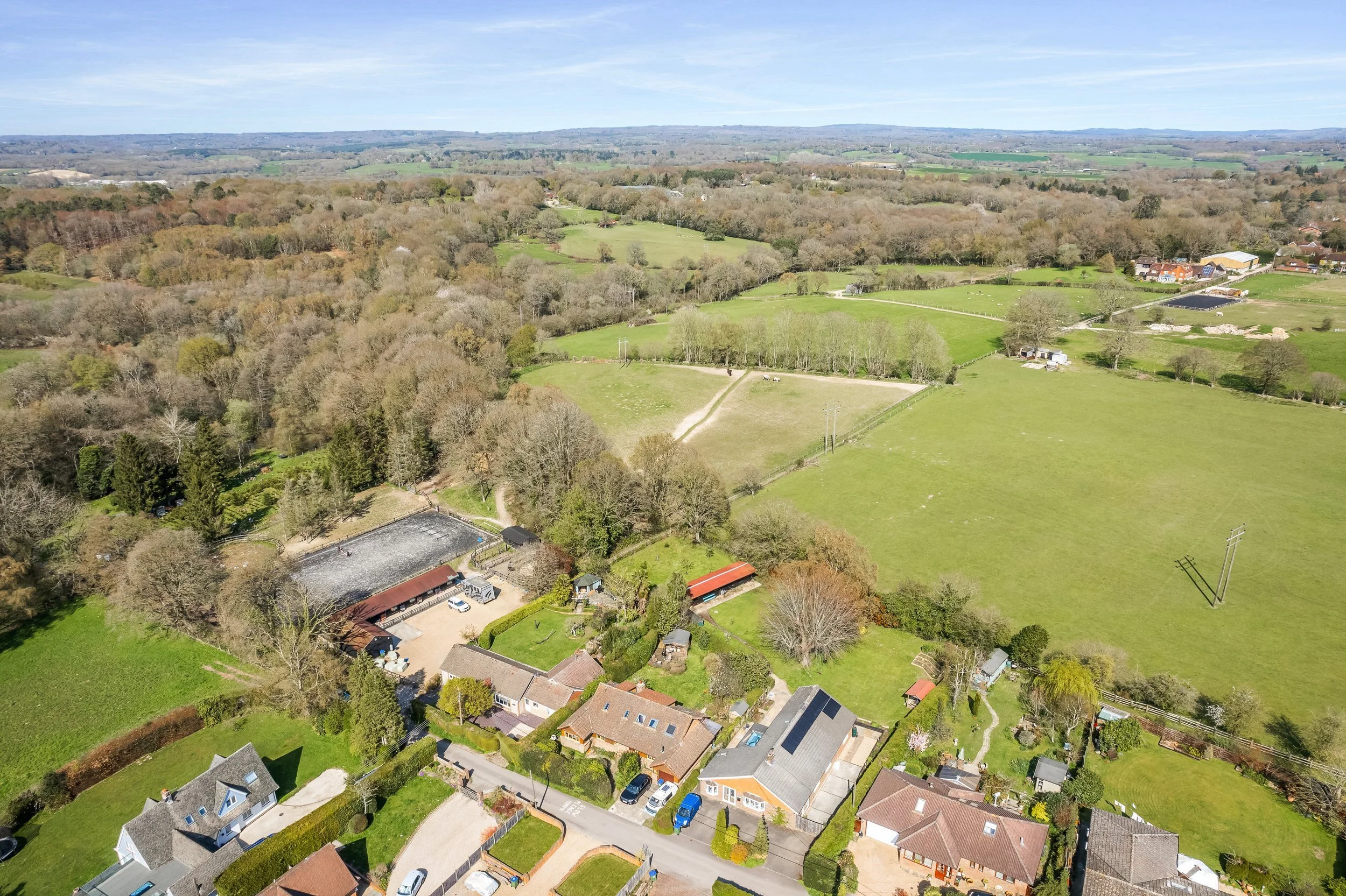
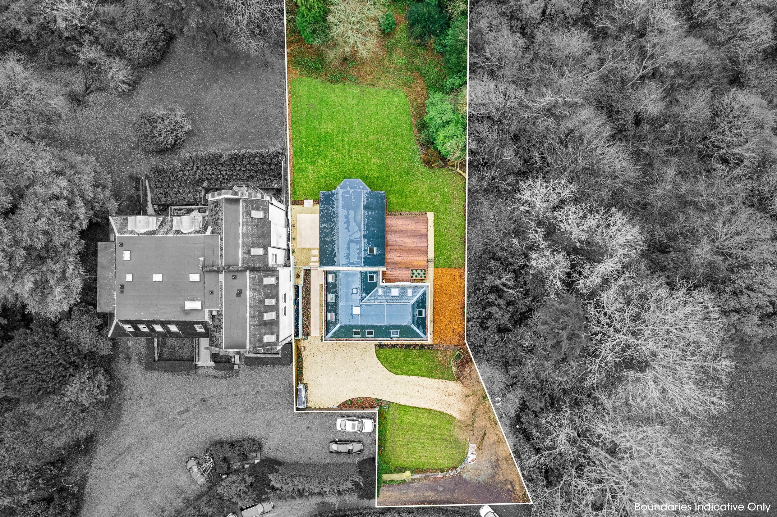
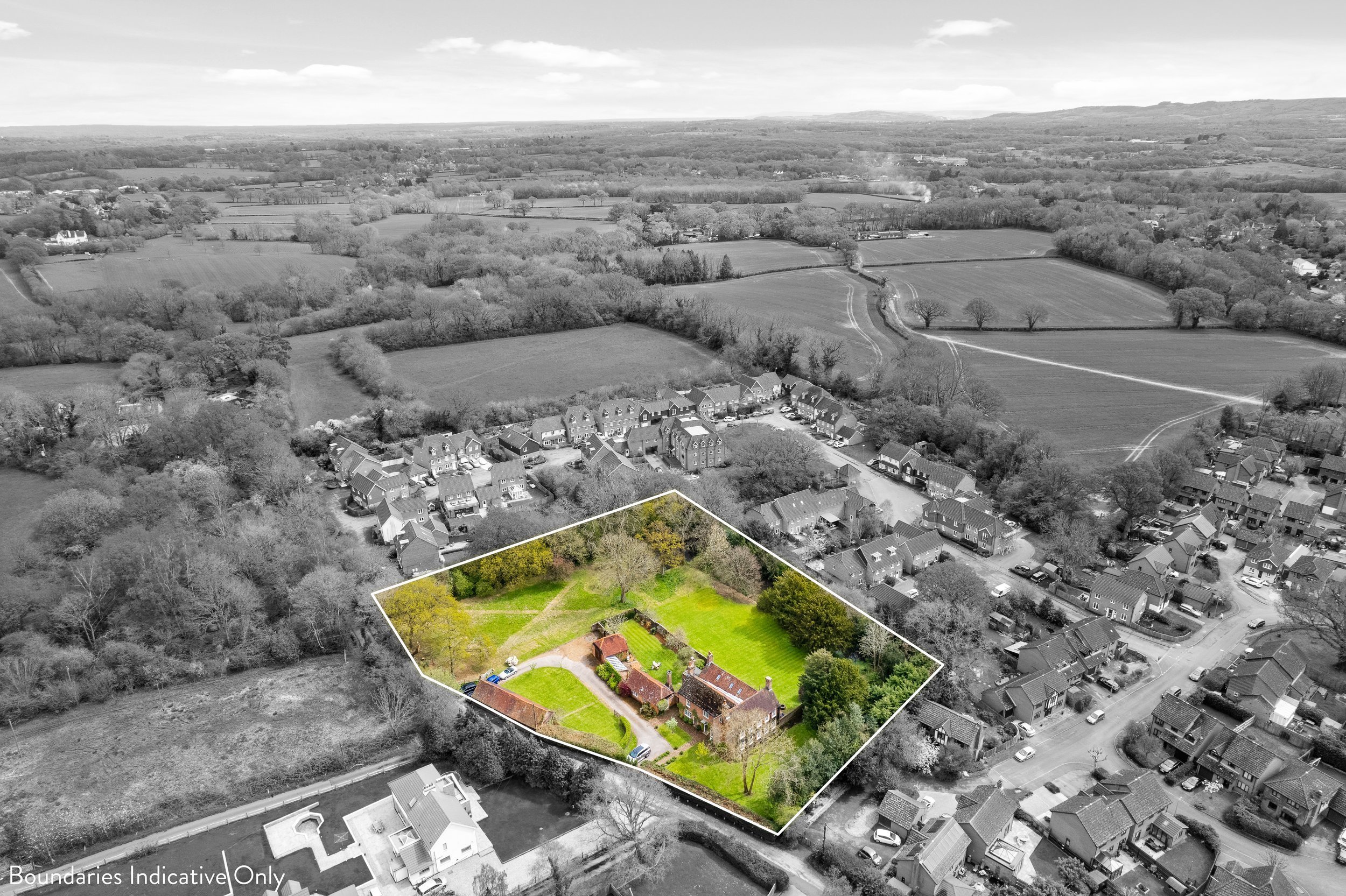
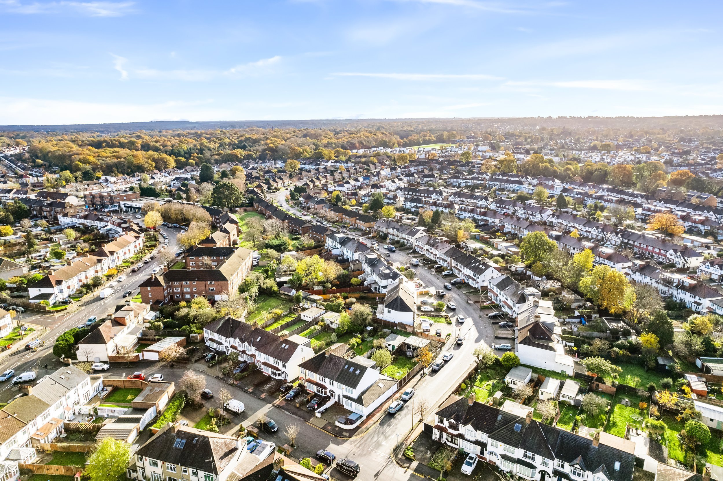
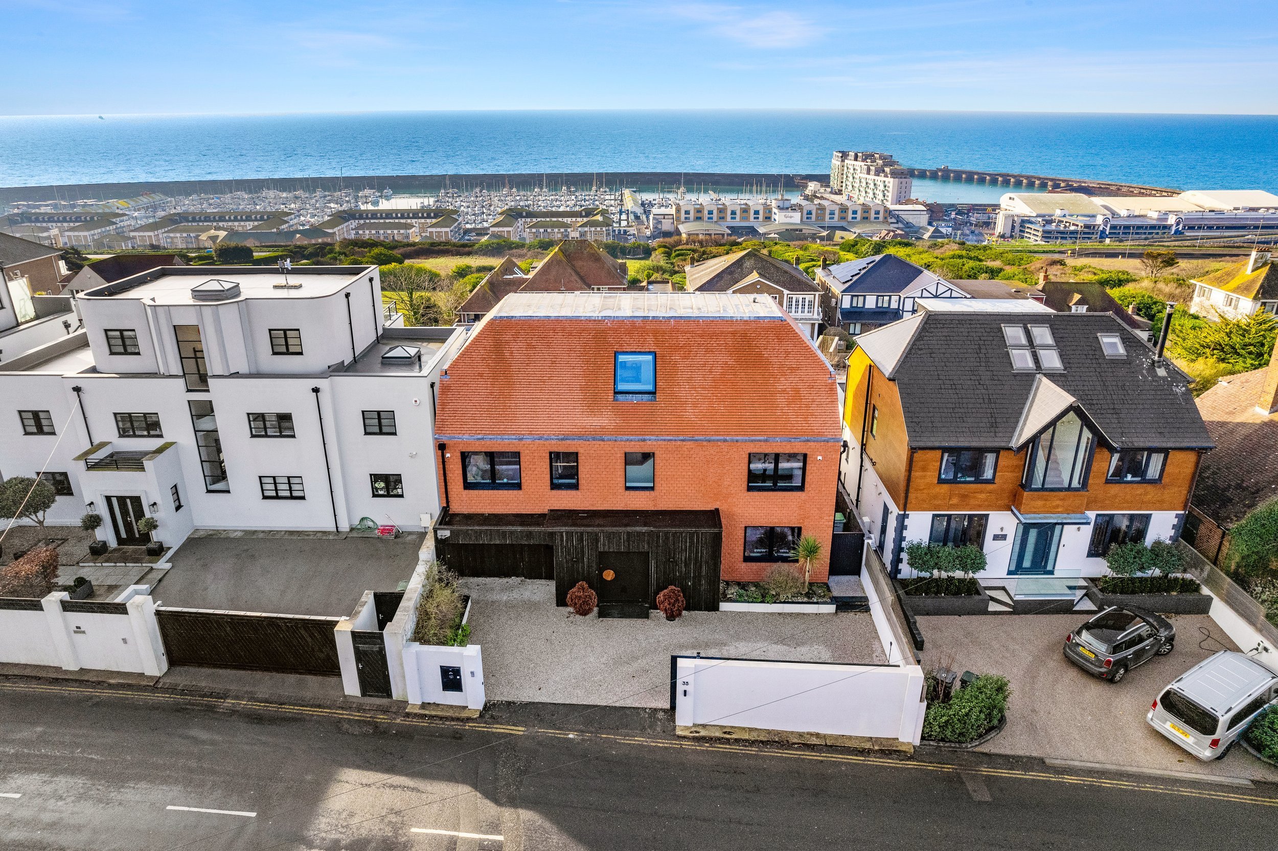
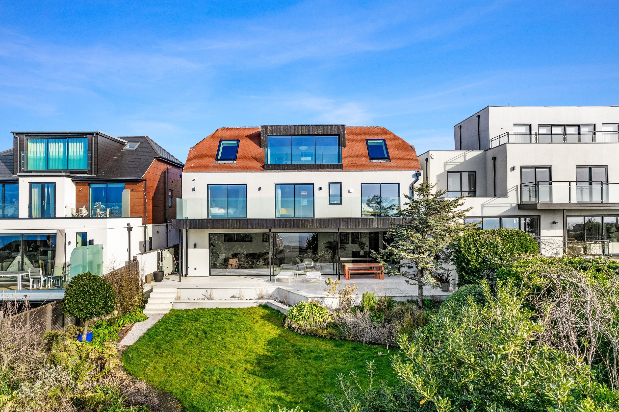
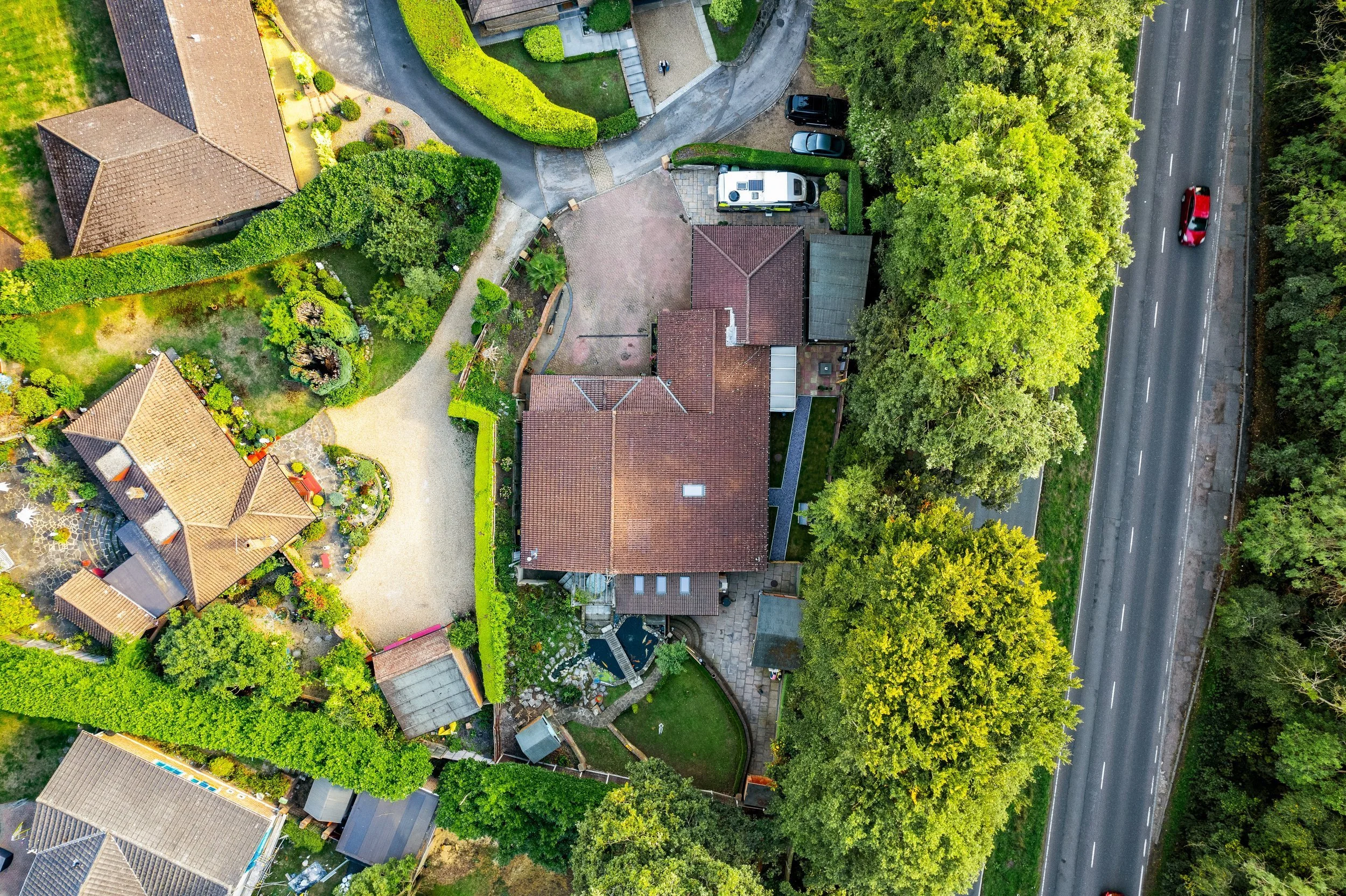
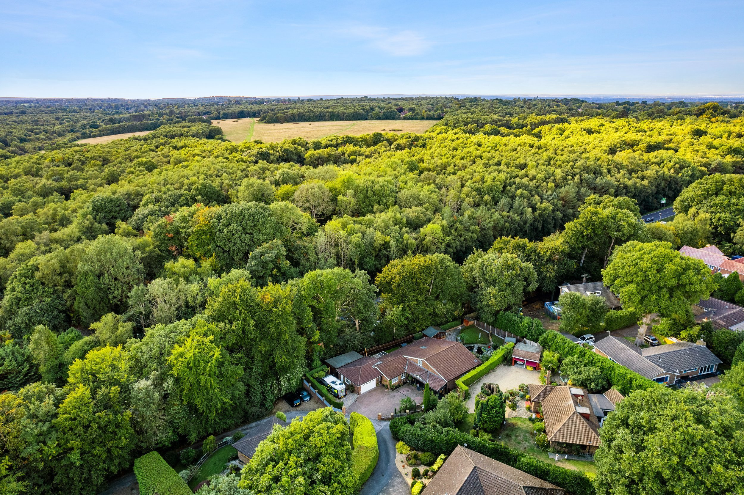
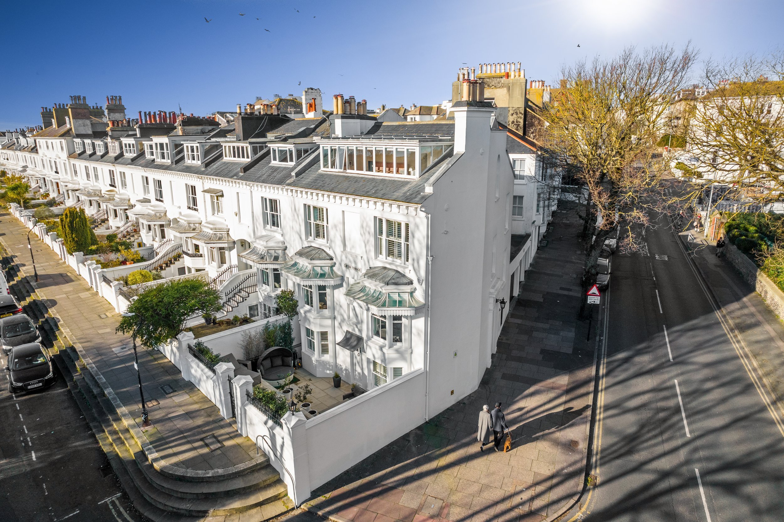
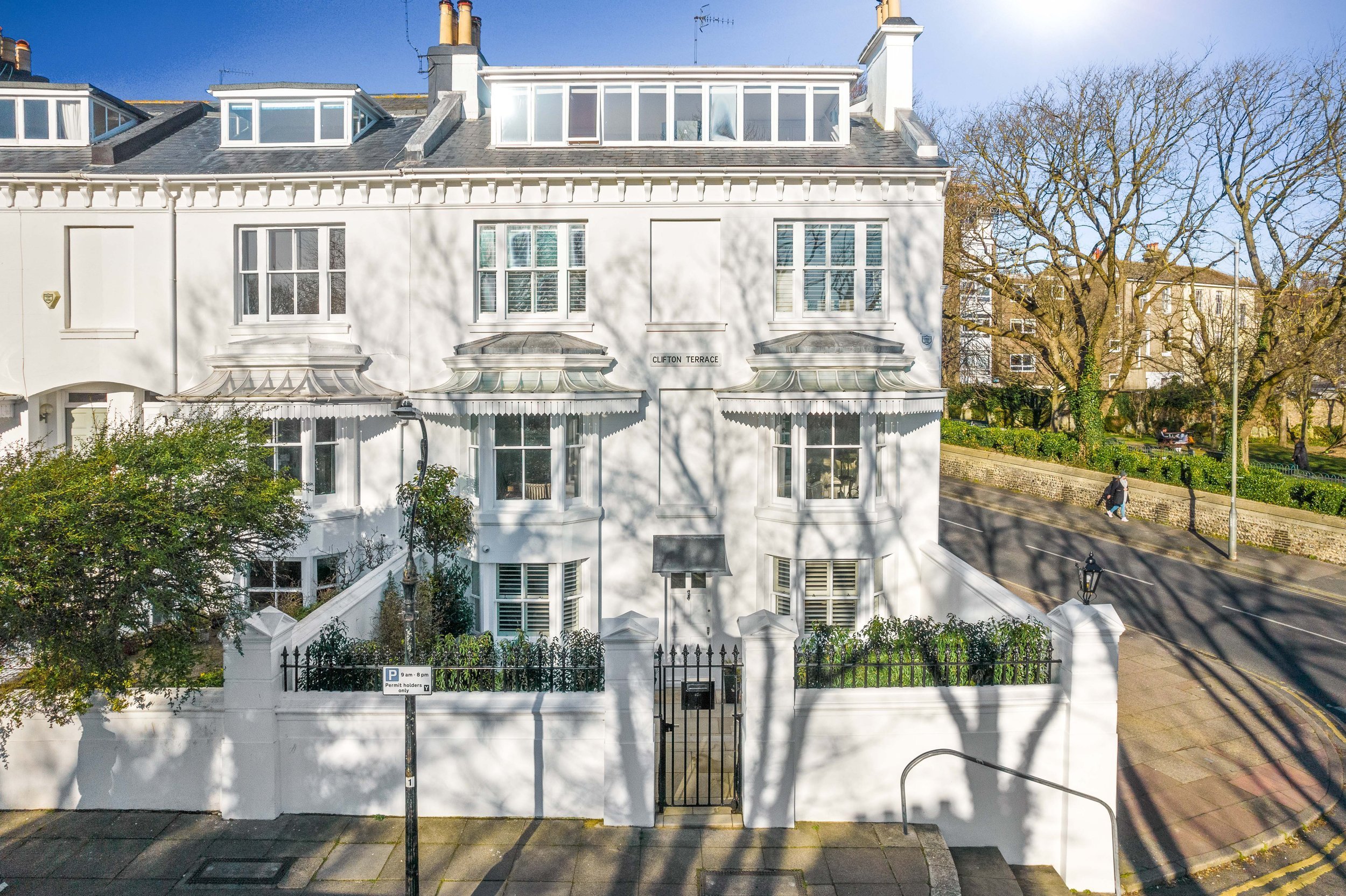
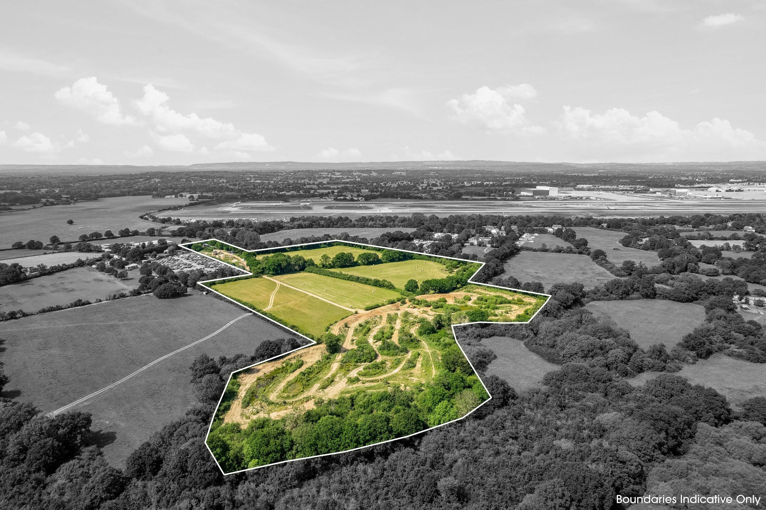
Drone aerial photography is unmatched. Showing space laid flat, with the proportions, size, scope, scale and surroundings clearly visible, the dynamic gives a viewing experience like no other. For homes, the intricate insight the technology offers provides detail, perception and perceptiveness crucial to assessing how a property works, demonstrating every aspect, from architectural features to landscape design, with clarity.

Storytelling, Scale & Visual Effect
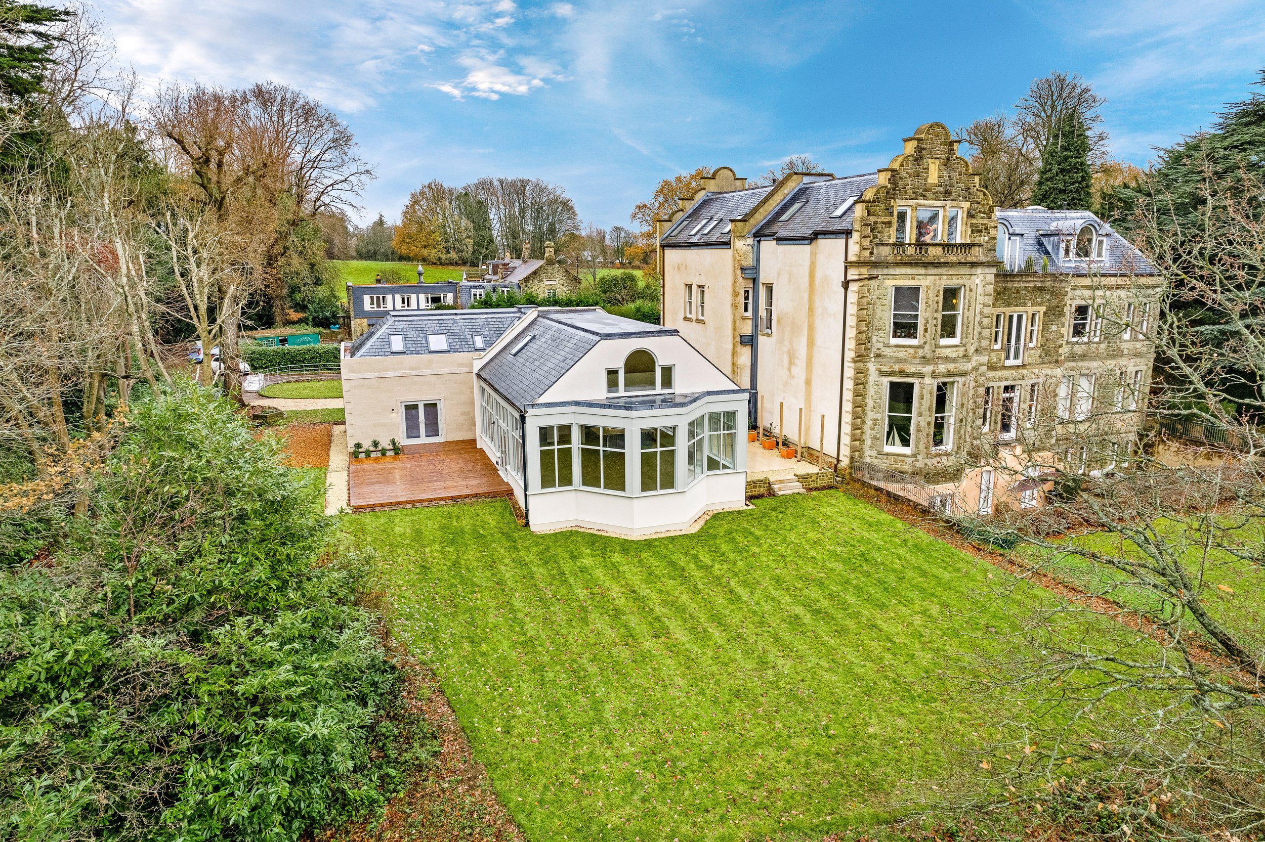
Every photo we take captures a narrative. From majestic landscapes to architectural marvels, drone photography captures the essence of what makes a place a place, highlighting its standout features and surroundings with stunning detail and clarity. Our images show a sense of belonging, capturing how a space can be related to on an individual level.
How We Work
Real estate drone photography shows your space in ways it can’t otherwise be seen. The dynamic of viewing a property from overhead, seeing its entire size, scale and proportions in one, offers a visual experience that allows you to interact with its interconnectedness. The act of capturing things from an atypical point of view motivates us to produce high-quality work that demonstrates the art of looking. Our footage is immaculately presented, providing a representation of space that showcases the nuances, variables and details of it.

Commercial, Flexible & Functional Assets
-
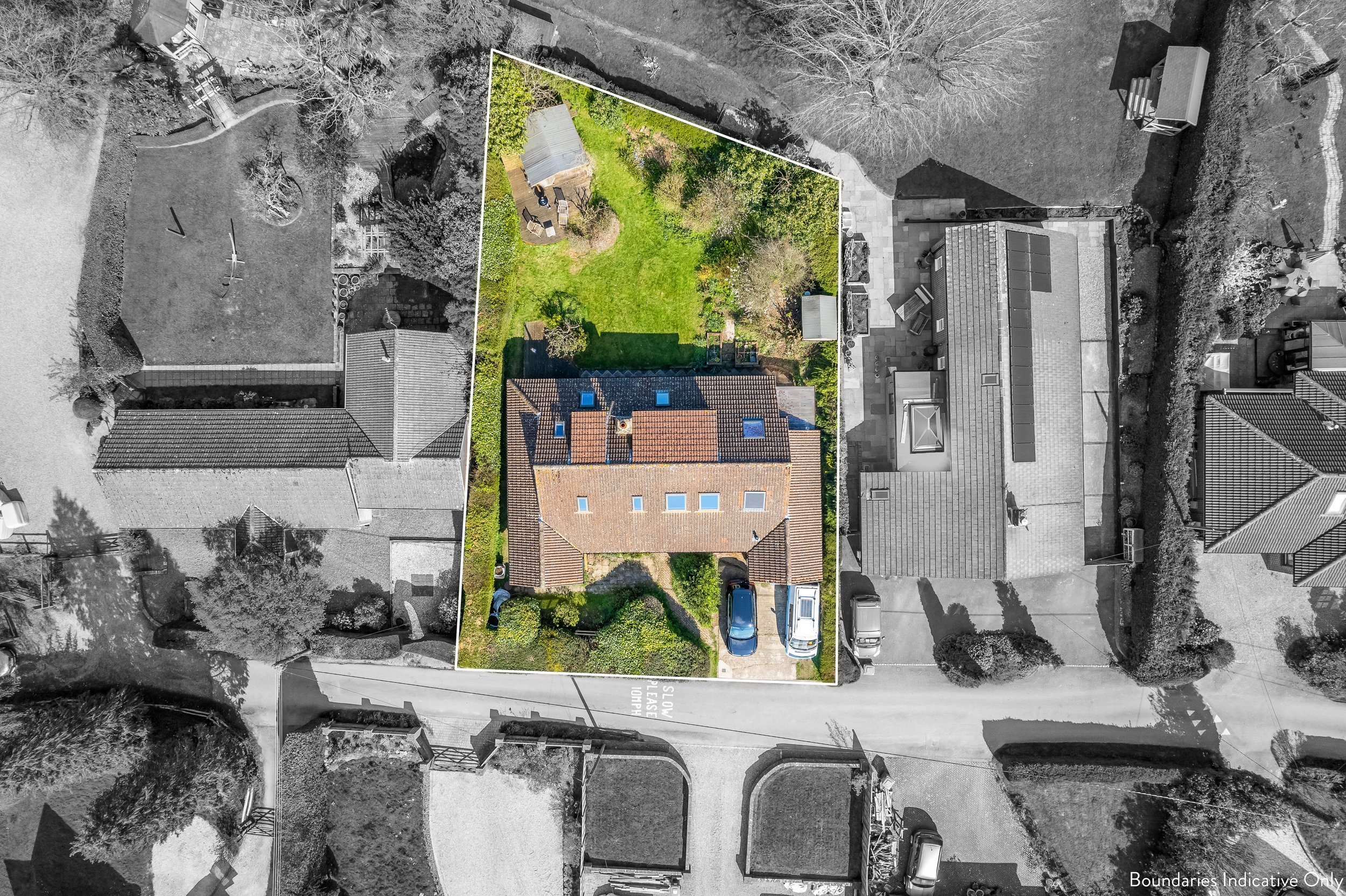
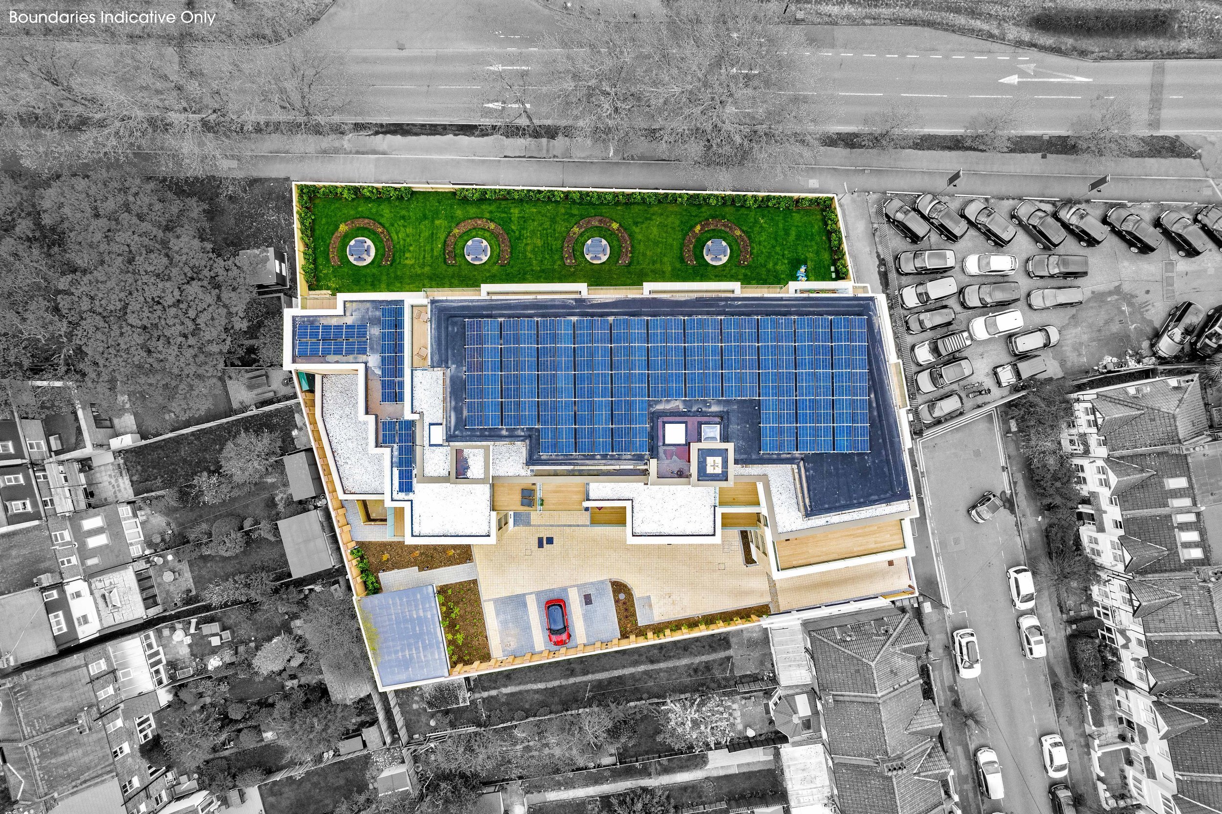
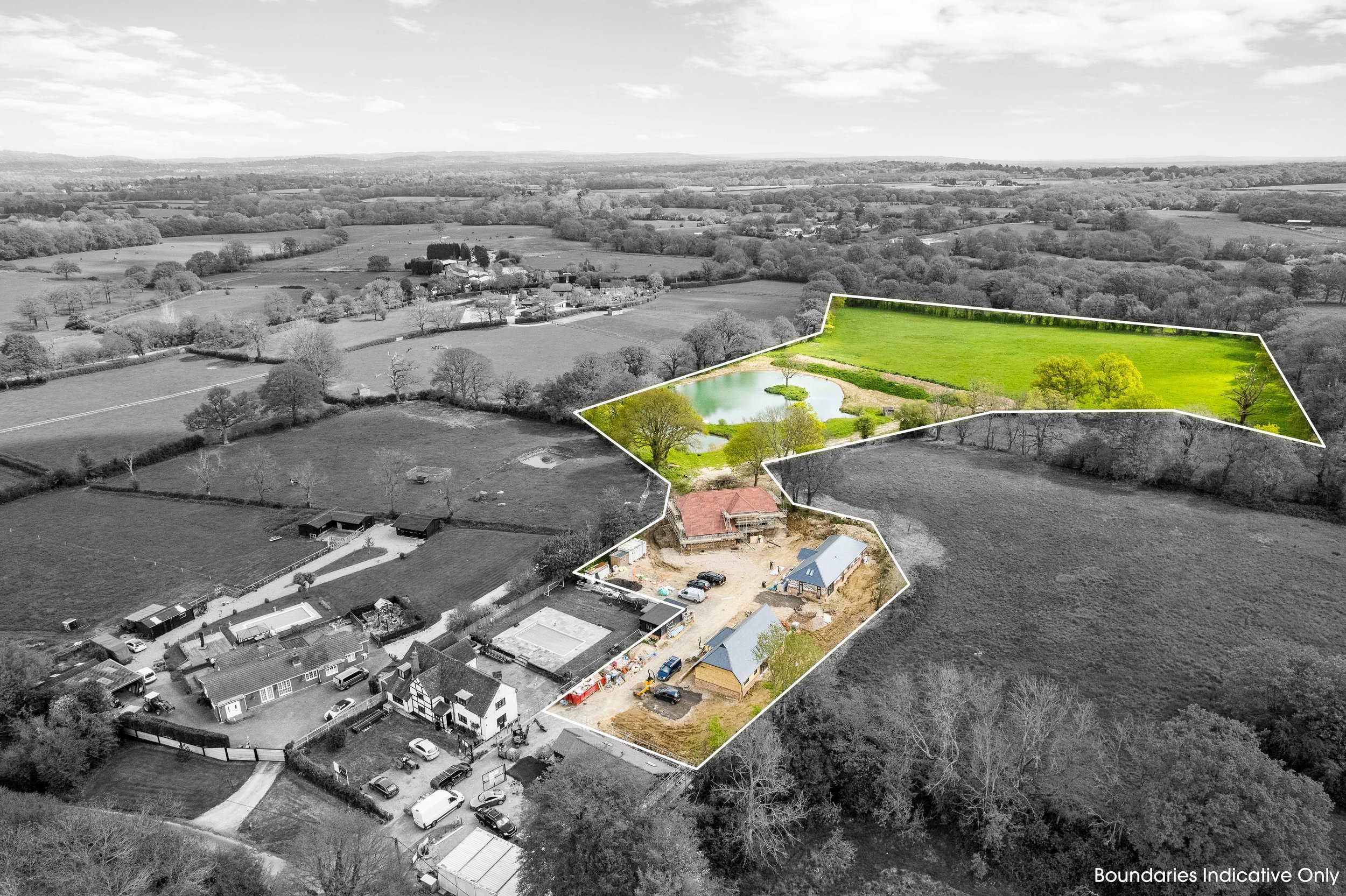
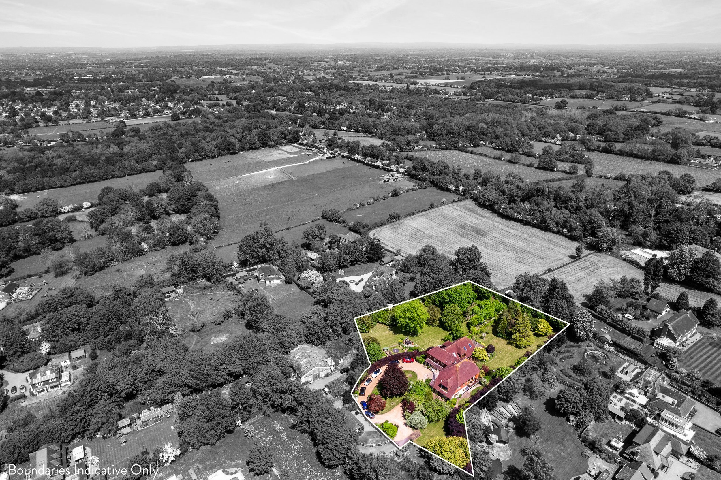
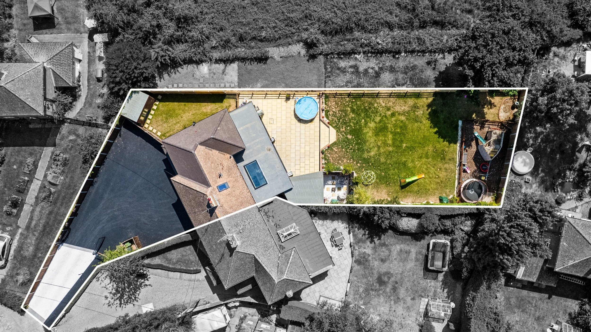
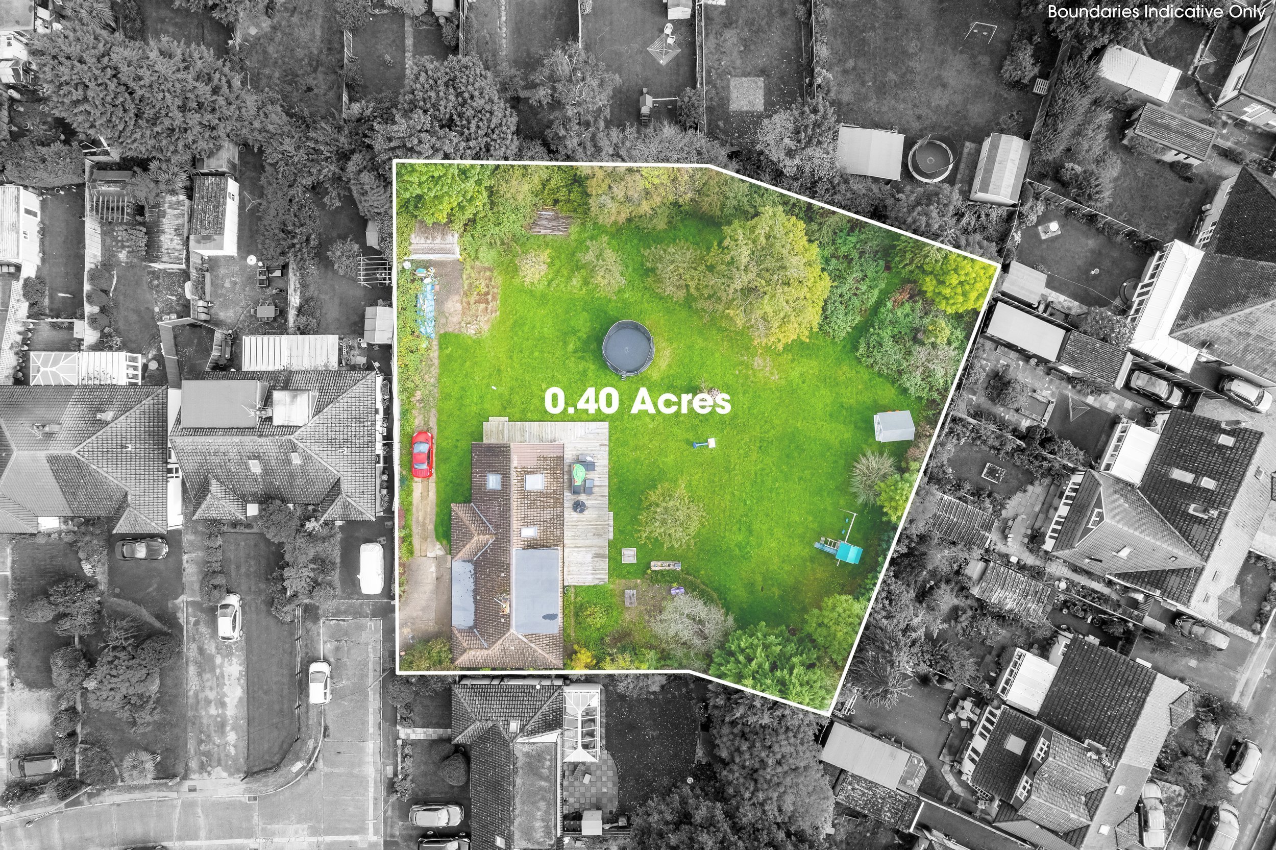
Provides a unique and comprehensive view of the property and its surroundings, showcasing features such as landscaping, proximity to amenities and nearby landmarks.
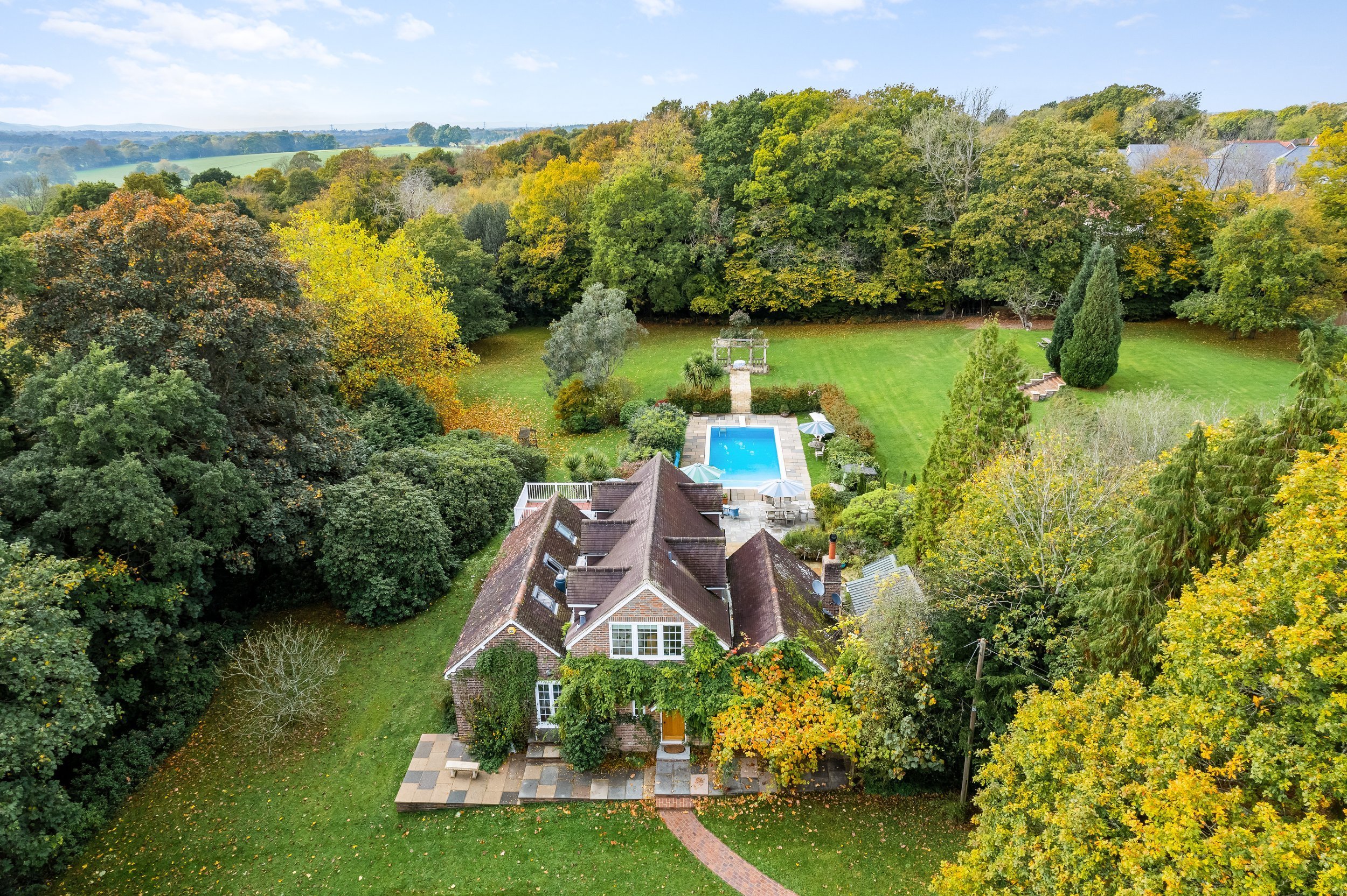
Highlights the property's layout, size and architectural details from an elevated angle, offering a more immersive and accurate representation.
-
Creates visually stunning and captivating content that grabs the attention of potential buyers, increasing engagement and interest in the property listing.
Differentiates the property from competitors and positions it as a premium listing, attracting more qualified leads and driving higher offers.
-
Presents the property with high appeal by capturing flattering angles and perspectives, emphasising its best features and minimising any potential drawbacks.
Provides a clear and comprehensive overview of the property's exterior, allowing potential buyers to visualise themselves living in the space and making informed decisions.
-
Allows potential buyers to explore the property remotely, saving time and effort by providing a detailed and realistic preview before scheduling an in-person visit.
Expands the reach of property listings to a wider audience, including out-of-town or international buyers who may not have the opportunity to visit the property in person.
-
Provides a visual record of the property's condition and features at the time of listing, serving as valuable documentation for sellers, buyers and real estate agents.
Facilitates communication and transparency between all parties involved in the real estate transaction, minimising misunderstandings and disputes.
The Art & Act of Drone Aerial Photography
The artistry of drone photography captures not only the physical attributes of a property but also its essence, revealing its connection to the surrounding environment and the potential lifestyle it offers. Each aerial shot frames space in a way that allows you to look closely at it, showcasing the intricacies of a property from a perspective that transcends the ordinary.

Present Yourself & Your Viewers With A Profound Perspective
Creating an immersive visual experience that invites viewers to explore and connect with the space on a deeper level, drone aerial photography ignites the way space is seen, performing actively and asking viewers to consider what they see intimately. From sweeping panoramas to up-close views, using drones for real estate photography allows you to focus on what makes a space the space it is.