
Capture New Angles With Real Estate Drone Photography in Brighton & the Surrounding Areas
We’re all about seeing. Finding new viewpoints, altering the way we take a visual in and expanding our view on things is what motivates us to produce our creative work. Our product is the image. We specialise in photography that depicts properties for sale in new and distinct ways, offering insight into how they’re built, what makes them standout and how they sit within the space, landscape and surroundings they occupy.
Drones in Brighton: What We Do
Aerial Photography: Capture stunning overhead images of properties to showcase their size, layout and surrounding environment.
Property Highlighting: Emphasise key aspects of the property, such as architectural details, landscaping and amenities, from an aerial perspective.
Panoramic Shots: Create wide-angle and 360-degree panoramic shots to provide a complete view of the property and its surroundings.
Dynamic Editing: Edit aerial evidence to produce high-quality images that highlight the property's best features and tell a compelling story.
Site Surveys: Conduct aerial surveys to gather detailed information about the property and its geographical context.
Marketing Content Creation: Develop visually appealing content for real estate listings, websites, social media and promotional materials.

Where We Work
A good shot is made so from production and editing. It’s a process. We commit thoroughly, editing all of our work at our headquarters in Hassocks, just North of Brighton, ensuring we represent local properties accurately to provide full insight into their location, characteristics and surroundings.
Our Story
At the core of our identity is an ability to seek out new spaces and represent them in artful and creative ways. After working in New Zealand within a marketing agency that specialises in real estate, the idea and concept of our business began. Founded on a love for storytelling through pictures, we’ve grown and grown, using imagery to form narratives about particular places and settings. We’re no longer a plan. We’re a reality, visibly producing high quality property photography to stimulate viewers.

Perspective & Presence
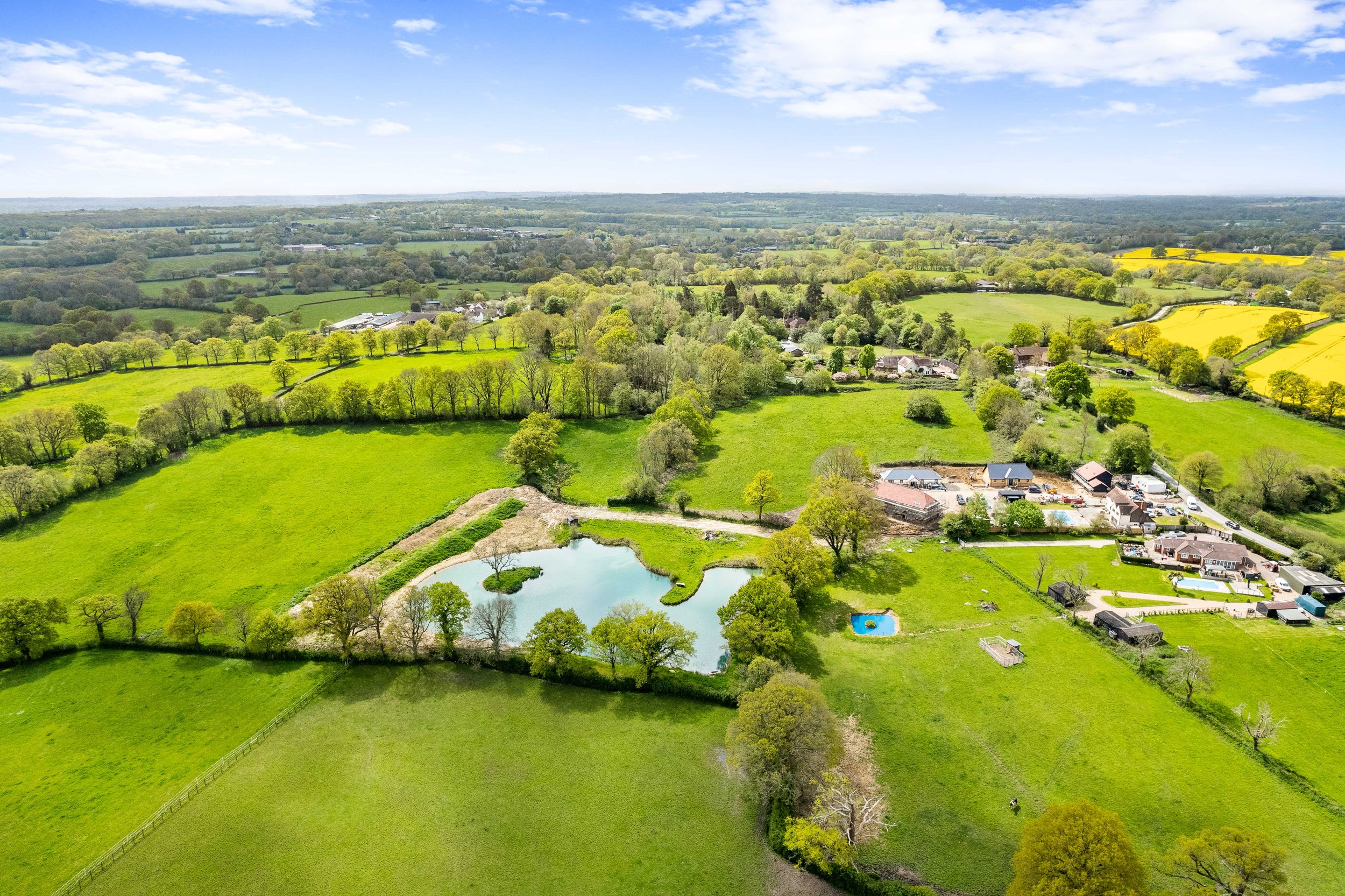
Real estate drone photography reveals your property in revealing, captivating ways. An overhead view showcases the full size, scale and proportions of a space, offering a visual experience that highlights its interconnectedness. Capturing properties from these unconventional angles inspires us to deliver high-quality work that exemplifies the art of observation. Our footage is impeccably presented, emphasising the nuances, variables and details that make each property distinct.

Documenting Real Estate Visually & Accurately
Pre-Flight Planning: We conduct thorough planning to identify key property features, optimal flight paths and ideal lighting conditions for capturing the best visuals.
Advanced Drone Technology: We use industry-approved drones equipped with high-resolution cameras and stabilisation systems to ensure sharp, clear images.
Aerial Mapping: We create detailed aerial maps that accurately depict the property's layout, boundaries and surrounding areas.
High-Resolution Photography: We capture high-resolution aerial photographs that provide a detailed and accurate representation of the property from multiple angles.
Post-Processing Precision: We enhance images through our meticulous editing processes, including colour correction, noise reduction and image stabilisation, to ensure accuracy.
Geospatial Accuracy: We ensure geospatial accuracy in all images and footage, providing precise data about the property's location and dimensions.
Comprehensive Coverage: We document the entire property, including exteriors, landscapes and surrounding areas to offer a complete visual overview.
Client Collaboration: We work closely with clients to understand their specific needs and objectives, ensuring the final visual documentation meets their requirements.
Playing With Proportion, Dimension & Scale
Drone photography transforms the way properties are perceived, playing with its build. By capturing aerial views, we offer a perspective that highlights the true expanse and layout of a property, showcasing elements that ground-level photography cannot. Our approach allows for a comprehensive visual representation, revealing the interconnectedness of structures, landscapes, and surroundings in an accurate manner.

Meet the Team
-
Director & FounderAs director and founder of Cenes, Brett has a wealth of knowledge and creativity surrounding photo and video. With over 10 years behind the lens starting out photographing his mates at the skatepark to travelling South East Asia extensively with camera in hand, he has always had a passion for capturing the moment. With a career in real estate marketing in New Zealand broadening his horizon to now, settling back into the UK, Brett has his sights set on bringing all his knowledge together in one place. Cenes.
Work With A Property Photographer in Brighton & the Local Area
Our dynamic imagery provides valuable insights into a property's overall design and spatial relationships.
Our drone aerial photography captures properties in a way that highlights what makes them desirable, offering a distinct perspective that makes each space stand out.
Contact us to learn more about our services, schedule a booking and collaborate with us on using drones for real estate photography.
Phone: 07563875156
Email: brett@cenes.co